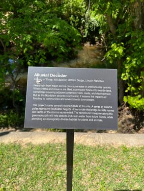
Alluvial Decoder at Crabtree Creek
A curious art piece along a lovely biking trail marks several historic floods via a series of colorful poles that represent floodwater heights.

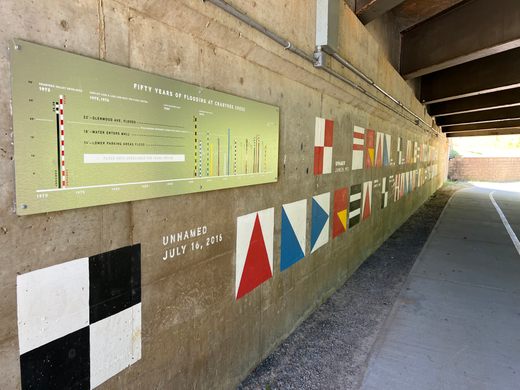

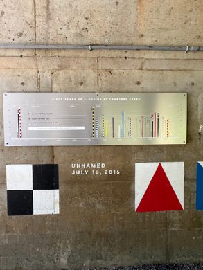
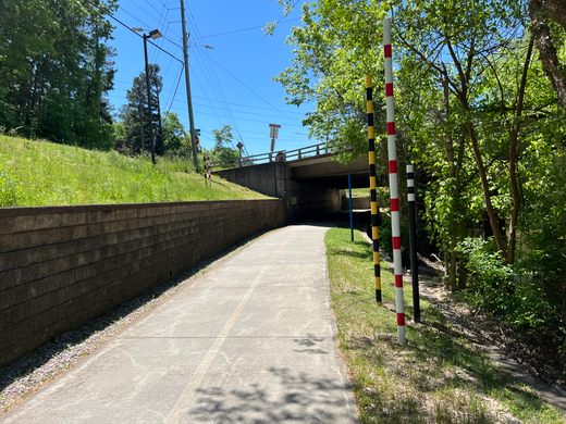

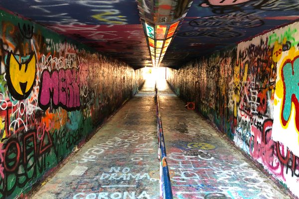
While traveling along an otherwise unremarkable stretch of the Raleigh Capital Area Greenway you may notice a series of colorful poles near an overpass bridge. These poles are components of an art project called “Alluvial Decoder”. The poles have tracked the height of every major flood for more than 50 years.
The accompanying plaque reads: “This project marks several historic floods at this site. A series of colorful poles represent floodwater heights.
A key under the bridge reveals the names and dates of the storms represented. The reinstituted meadow along the greenway path will help absorb and clean water from future floods while providing an ecologically diverse habitat for plants and animals.”
The mural also contains the names of the various floods that have caused major flooding in the Raleigh, North Carolina region. So, take a look when the river is low and you’ll get a feeling for the scale and power of water and its ability to impact and reshape the environment.
Know Before You Go
Open to the public year round. Avoid visiting during/after heavy rain.


Follow us on Twitter to get the latest on the world's hidden wonders.
Like us on Facebook to get the latest on the world's hidden wonders.
Follow us on Twitter Like us on Facebook